Classic meteorology
Sometimes the weather can be a complicated machine, with chaotic patterns which cause us forecasters no end of trouble in trying to tell a story even a couple of days ahead.
However, there are also times when things couldn't be more 'typical' and pan out just as a meteorology text book would expect. This is one of those occasions!
Polar Maritime westerlies in the middle of winter are an absolute classic. A brutal classic, but one which brings a very clear weather story. The satellite image below from today (Tuesday 11th Feb - courtesy meteocentre.com) shows the situation nicely... (text continues below...)
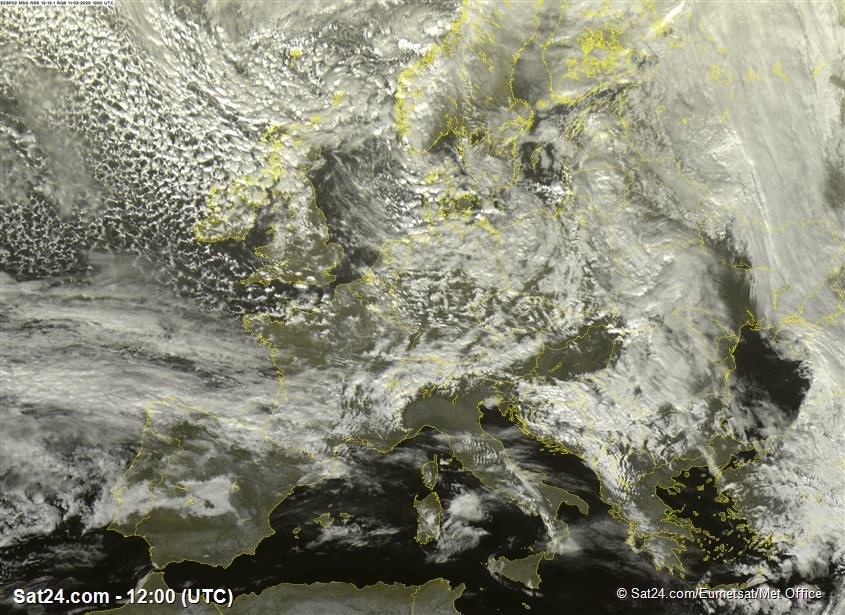
The atmosphere over the north Atlantic is absolutely full of shower clouds, piling into the British Isles with the full kitchen sink of snow, hail and thunder. The 'showers' terminology is used cautiously in our forecasts for western mountains. They are certainly not what you might think of as 'passing showers'. They are so frequent that it is snowing or hailing almost constantly in places. Add in the blowing snow in the wind and you can't really tell when it is precipitating or not!
They are, however, very much 'convective' features, set in motion by the large contrast of temperature between at the ocean surface and the higher atmosphere (troposphere) to be exact. The chart below is a forecasting chart from the '500 millibar' level, which is found at about 5km above the Earth surface.
It shows temperatures here are well down into the -30s Celsius, and they have been nearer to -40C briefly (text continues...)
These values are a fairly normal occurrence for a powerful 'Polar Maritime' air mass. The original air has been dragged out of northern Canada and Greenland, and then out over the Atlantic. As the very cold air moves over warmer sea, it is modified to some extent, but the inherent low temperatures high above the surface makes the air mass very unstable. In situations where the 'lapse rate' is high - ie. temperatures fall rapidly with height - the air can rise buoyantly, forming the towering shower clouds, and eventually the hail and thunder we are seeing at the moment.
Recent powerful weather patterns have meant this westerly episode has brought the coldest air of this winter from this direction, with the freezing level right down below 300-400m, allowing snow to fall and lie to almost sea level.
From a forecasting point of view, the only really complicated factor is whether there are little 'ripples' in the flow, which clump the showers together as 'troughs'. Otherwise, it is one that works pretty much like clockwork.
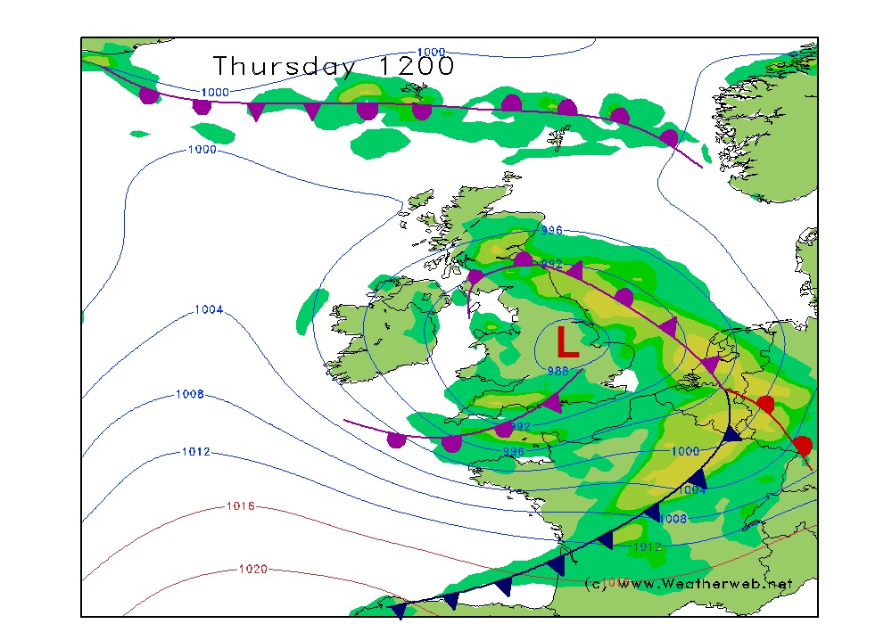
Things become more complicated again by Thursday, as the flow patterns change, and a new centre of low pressure lumbers into the mix. With that, confidence lowers, and we have to watch the atmospheric movements very closely, because things are more on a knife edge in terms of precise local detail for snow, rain and wind.
Stay up to date with us daily here at MWIS!