The May Day Bank Holiday is almost upon us, and there's a few weather headaches lining up for the last part of the extended weekend.
It's pretty straightforward at first, with light winds, cool air and scattered showers forming on Saturday and Sunday. Expect hail and snow flurries across the hills. Beware of the heavier showers containing thunder, but as a general rule, this will be very rare - one isolated flash of lightning is perhaps all there will be. Watch the skies around you if things do start to look ominous though, and head away from exposed crags and ridges as soon as possible.
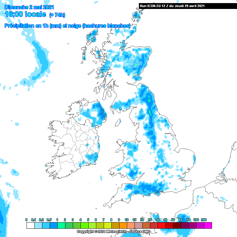
The precipitation forecast chart below for Sunday afternoon highlights fairly extensive showers again, with eastern regions most likely to catch heavier showers. Some western coasts will become sunnier, especially across England and Wales, as an increasing southwesterly wind here ushers the showers further away eastwards. However, this wind is the forerunner of Monday's weather... (continues below the map!)
Things are likely to become more 'mobile' weatherwise as we start next week. Yes, the weather knows there's a Bank Holiday on the way!
There's still some wriggle room in terms of how this system behaves. The computer simulations can't yet exactly predict the speed at which a developing Atlantic system will move into Britain (one model chart shown below), but it's starting to look more likely that we will see a deterioration in conditions for Monday. Once we can see 'the white of its eyes' so to speak, we'll know just what sort of animal we're dealing with!
It's likely to become much windier, and a threat of developing into gales over the hills for some areas on Monday. Weather fronts sweeping in would bring more widespread precipitation, rather than spotty showers. Rain which would set in for several hours, heaviest on western hills.
Although temperatures will rise as this system moves in, it may be cold enough on the leading edge of this system for snow to occur on the hills, even to modest elevations - the greatest risk of this across the Highlands. Indeed, northern areas may stay in markedly chilly air throughout the day, depending on the track of the low.
The rest of the week is looking like more showery conditions, and a possibility of another low coming in to bring some wind and rain, plus upland snow again, as we can't quite shake off the chilly air!
Stay up to date with all our content, including our videos - the Friday Planner will have your full outlook for the week ahead, and the 'Fleeting Views' will monitor developments through the long weekend.