Atlantic weather patterns prevail during the week ahead meaning precipitation will be frequent and copious across our western hills and mountains. Mostly sub-zero conditions will exist on higher tops in Scotland, so any periods of thaw up on the Munros will be very brief, doing little to reduce the snow cover here.
There will be day to day variations in freezing level however, with milder air hanging around for longest over England and Wales, allowing for more marked freeze and thaw cycles here. At times much of the snow will thaw, but even on the milder days, areas of consolidated snow will survive though on higher tops in the Lakes and Snowdonia.
Precipitation will be a mix of snow, rain and hail through the week as frontal systems sweep through. The showery days bringing that more icy mix down to lower elevations as colder air returns.
Flooding is a concern on low ground, particularly England and Wales in the next day or so, as high rainfall totals occur during Sunday's weather system. Saturated conditions underfoot and streams widely in spate. Lower areas in western Scotland will be often very wet too. Some rivers flowing east will also rise significantly and may flood.
On the high tops, beware of icy terrain during the week ahead where there is some freeze-thaw action. Also note that Scottish tops will have some considerable snow depths and drifting, with much wind blown snow from the ongoing gales. Beware of the avalanche risk and refer to the info from the Scottish Avalanche Information Service.
Visibility will be sometimes reduced to periods of whiteout even when it isn't precipitating, with a lot of snow blowing about on the high tops in the gales or severe gales at times.
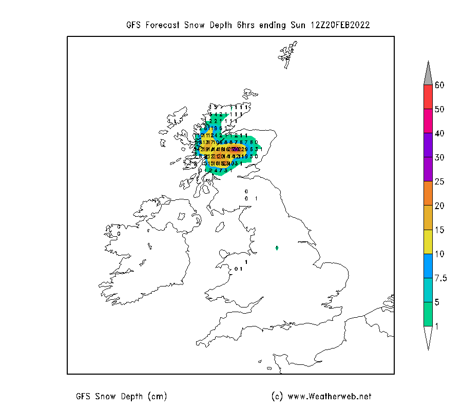
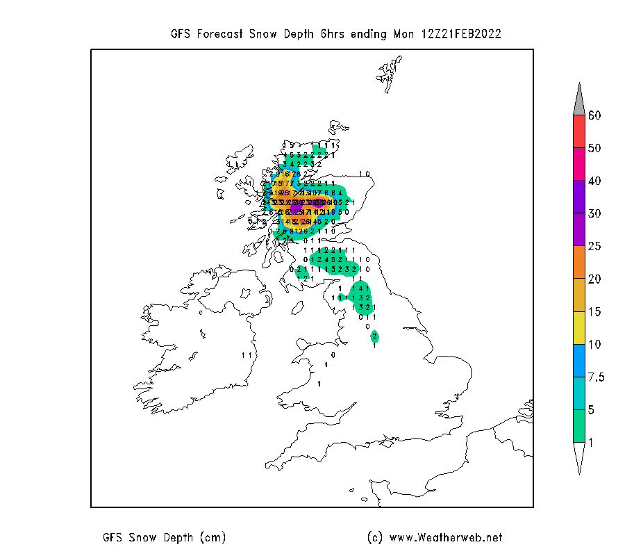
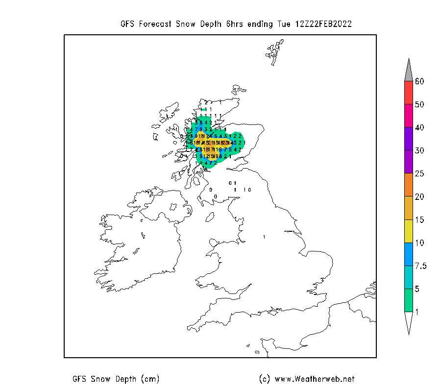
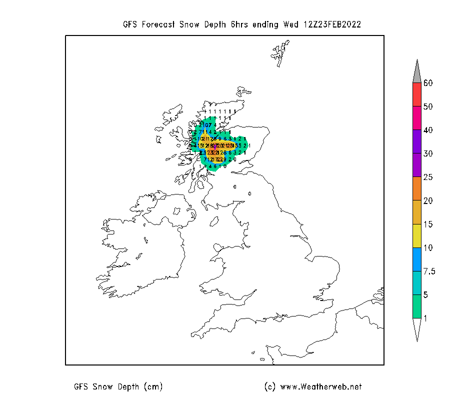
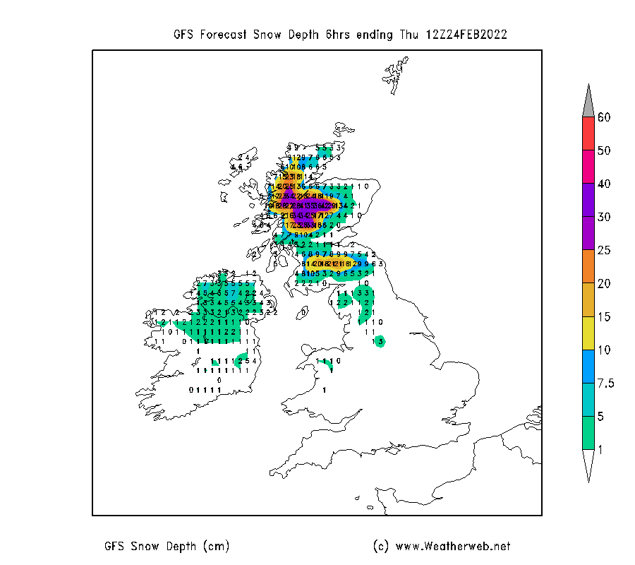
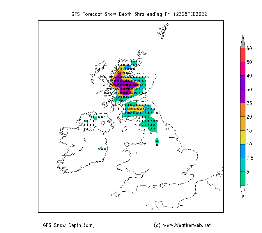
The charts below are a series of snapshots of the expected snow depths through the week ahead, as forecast by one of the computer models. Note this isn't how much new snow is expected to fall at these specific points in time, but it is what is due to be lying on the ground at the given time. Each chart is the picture up to midday day-by-day. You'll see how things wax and wane through the week. Bear in mind local variations on the mountains, but this gives a pretty good guide of what to expect.
Stay safe on the mountains, and enjoy it if you can, but beware of some wild and severe days ahead once more.
#thinkWINTER