Stormy Monday ahead
An area of low pressure developing to the northwest of Britain through Sunday will deepen rapidly overnight into Sunday. The centre of the low then tracks eastwards just to the north of Scotland through Monday. The greatest squeeze in the isobars lies to the south of the low, resulting in widespread gales for Monday - widely stormy conditions over the mountains.The latest computer simulations have picked up on subtle changes in the development of the low and its interaction with colder air to our northwest. This meant an increase in the wind speeds was necessary in our latest updated MWIS forecasts for Monday, especially in the Highlands.
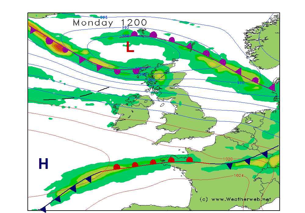
Likely reaching 80mph on the Munros, and I wouldn't be surprised to see some 100mph gusts reported on Cairngorm or Aonach Mor weather stations - a fairly common occurrance it must be said on our high tops on the wilder days each winter. This 'storm' will take a name if the UK Met Office or Met Eirann in Ireland decide amber weather warnings are necessary for the lowlands.
Again, all down to the latest simulations of the shape of this low, freezing levels are now expected to drop a little quicker, so showers will come down as snow or hail to increasingly lower levels through Monday, merging to longer periods of precipitation in the West Highlands.
Of course we'll look at all the latest data again tomorrow, and tweak the forecast details as we do 365 days a year. Either way, it's due to be a brutal day on Monday across the mountains, particularly in Scotland.
As discussed in Friday's planning video, I can still dangle the carrot of Wednesday being the better day of the week as pressure builds briefly across the country. That's your window of opportunity, because the Atlantic weather patterns are due to steam back in after that!