By MWIS Ambassador, Mehmet Karatay/Northern Aspect Mountaineering
Some days there are strong gusts on the supposedly sheltered sides of mountains. Mehmet explores why we get these gusts and how much this happened on Saturday 19th March 2022 in Coire an t-Sneachda in the Cairngorms National Park.
Strong downslope gusts: why?
Often MWIS forecasts refer to ‘strong downslope gusts’. The UK-wide summary of the forecaset for Saturday 19th March 2022 did exactly that:
“Dry with extensive sunshine across Britain. Very strong and gusty southeasterly winds, sudden turbulent gusts downslope and around some corries, over 50mph in western regions. Well above freezing on the tops, locally very warm to the northwest of major mountain groups. Lying snow remains on most Scottish Munros.”
Did the forecast play out and what causes this peculiar effect? Shouldn’t the lee of mountains be relatively calm?
Cairngorms NP and Monadhliath forecast
The Cairngorms NP and Monadhliath forecast described Saturday's wind as:
“Southerly, speeds locally varied, 20mph up to 40mph in places, including sudden gusts into northern corries. Speeds tending to increase during the afternoon into evening, risk gusts over 50mph.”
Gusty Observations
I was working in the northern corries and made casual wind observations throughout the day*.
When we arrived at the Cairngorm car park there was a steady southerly wind of about 30 mph. As we walked into Coire an t-Sneachda, the steady winds eased and became increasingly gusty. When there were no gusts, the winds were 15 to 20 mph but then gusts of 30 or even 40 mph would occasionally hit us. These seemed to get more frequent and sustained as we walked in.
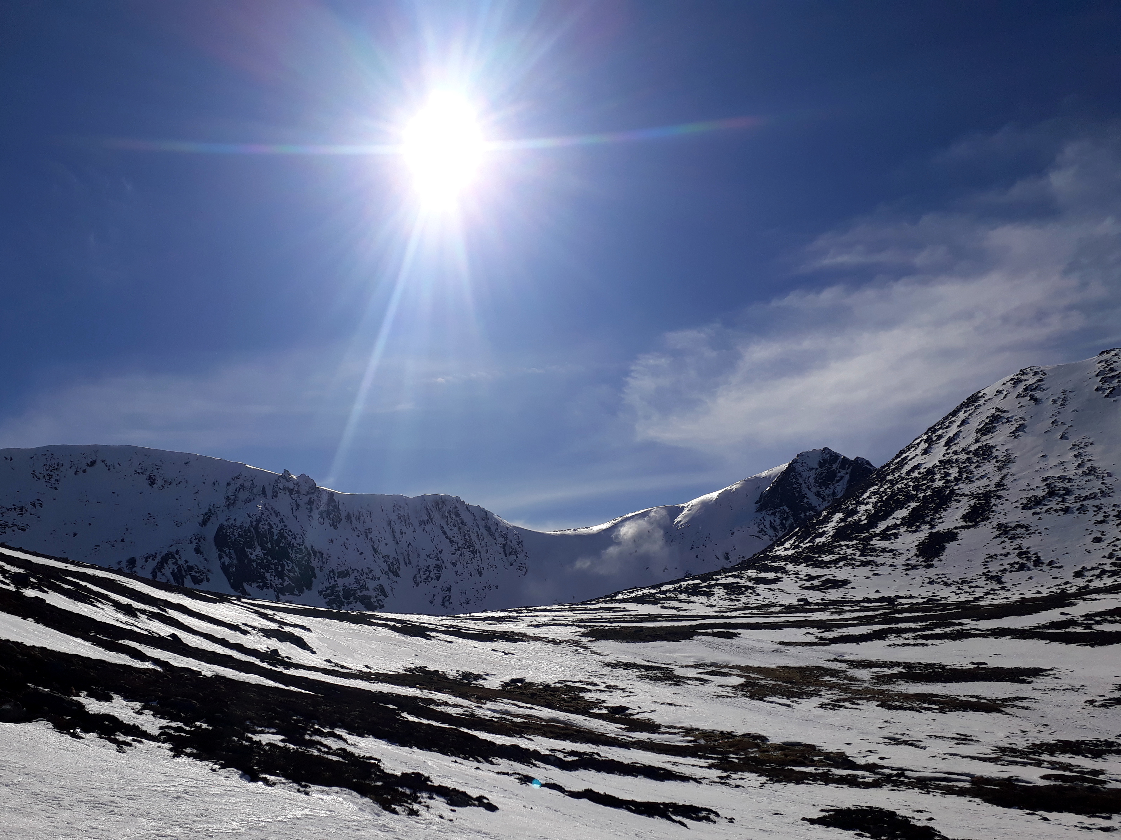
Clear skies but gusty in Coire an t-Sneachda around midday. You can see spindrift just to the right of the Goat Track, catching the sun on the otherwise shady headwall. We watched it rolling as the air broke into turbulence off the plateau.
Image credit: Mehmet Karatay/Northern Aspect Mountaineering
Once near the inner corrie, my team headed to the Sneachda moraine which is on the east side of the corrie with a small hollow between it and the Fiacaill a Coire Cas. In the hollow, we were in light winds but once we finished our training and returned to the main path the higher the gusts of 30 to 40 mph resumed. My instinct is that the path remained gusty all day and that we happened to find shelter at the side of the coire but I don’t know for certain. There may have been a perfectly-timed lull that coincided with our time over the moraines but this seems unlikely.
* I estimated windspeeds using my experience as a Mountaineering Instructor. This means the numbers are probably not accurate but their relation to each other should be correct.What causes downslope gusts?
Gusts in the mountains are basically turbulence in the airflow due to the mountains disrupting the steady flow of the wind. Think about the pictures you see of objects in wind tunnels or, in the case of the adjacent photo, a toy car in a pool of dyed water. Mountains do much the same thing.
In meteorology, we often think about whether the air is stable or unstable. A stable air flow means that the ‘layers’ of the atmosphere (green lines in the photo) are not trying to change where they are in relation to each other. South-easterly winds often produce a particularly stable air in the lower atmosphere as warm air from the continent flows over the cold North Sea. This cools the air from the bottom which removes any tendency for the lower layers wanting to rise through a higher layer.
As the image of the car shows, stable air ‘hugs’ the surface and gets pulled slightly down behind objects/mountains. In fluid dynamics terms, stable air exhibits laminar flow (green lines) which breaks into turbulent flow (orange mess in the photo) downwind of obstacles*. The gustiness on downwind slopes is explained partially by the eddies in the turbulent flow (orange area) and partially by the laminar flow (green lines) hitting the mountain surface at mid-levels. In Coire an t-Sneachda with a stable south-easterly wind, the gusts often come from the north or north-west due to turbulence, but this didn’t seem to happen on Saturday.
*For those of you who are interested, Reynold’s number determines the wind speed at which laminar flow breaks into turbulence.

A toy car in dyed water. Green lines show laminar, stable flow. The orange areas show turbulent flow.
Image credit: Eric James/NASA
Further information
If you want to understand this better I highly recommend Veritasium’s Turbulent Flow episode on YouTube. It is 18 minutes long, but if you are short of time, watch from 11:44 to 13:33 where Derek Muller demonstrates how adding dimples to a golf ball, whilst adding drag, actually make the golf ball fly further. The same physics explains down-wind gusts in mountains!
Mehmet Karatay, Northern Aspect Mountaineering
Mehmet is a physics graduate and is training as a forecaster with the Mountain Weather Information Service.