By MWIS Ambassador, Mehmet Karatay/Northern Aspect Mountaineering
How do showers differ between summer and winter? Mehmet explores a day when the UK experienced both winter and summer weather patterns.
Winter & Summer Showers
A key difference between showers in winter and summer, besides whether the precipitation is snow, is where these showers happen.
In summer we get showers over land as fair weather clouds build in the afternoon and potentially turn thundery. In winter a similar process happens over the sea but this is less well known. During spring, both may happen and this article explores such a day.
Summer showers
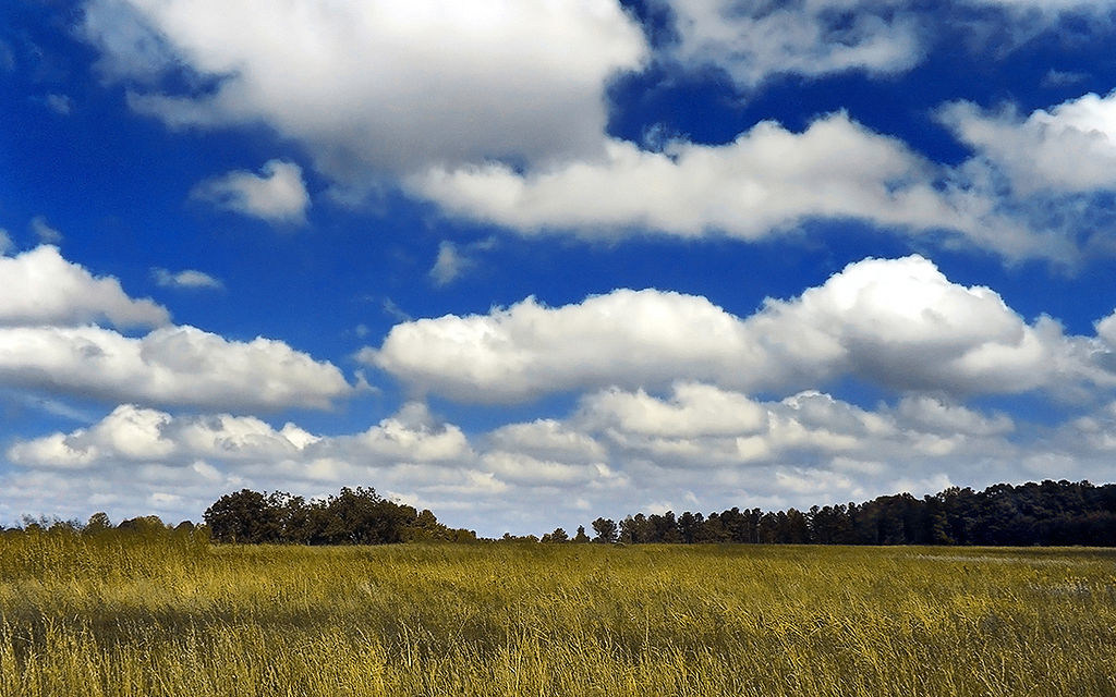
Fair weather, or convective, clouds over England. If these get taller they will produce showers and perhaps lightning.
Image credit: PiccoloNamek/Wikimedia Creative Commons CC By-SA 3.0
The mechanism for summer showers may be familiar to you but here’s a quick recap:
A fair summer day will often start with clear blue skies. The air may be cool and will get colder higher in the atmosphere, perhaps significantly so. As the day progresses, the sun heats the ground and surface air temperature increases. This will be patchy, with darker areas, such as some fields, warming up more than their surroundings.
When the air in these regions get 2 or 3C warmer than its surrounding, this ‘bubble’ of warm air will lift off like a hot air balloon. The air in this thermal will cool as it rises but it may still be warmer than the surrounding air and so keep going. At some point it will cool sufficiently to form cloud and, as the day progresses, rain. If the upper atmosphere is sufficiently cold, it will keep going perhaps up to 10km and form a thunderstorm. Hot air rising is part of convection and so the weather this produces are called convective cloud/showers.
To complete the convection cell colder air must descend around the outside of the cloud. The descending air warms as it comes down which means it can hold more moisture. Any cloud that was present dissolves into the descending air.
The key point of this mechanism for today’s story is that the summer sun heating the land surface is the driver of the afternoon showers.
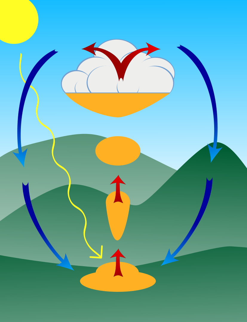
An idealised convection cell, showing a bubble of air, heated by sun-bathed ground, rising like a hot air balloon then colder air descending down the outside.
Image credit: Mehmet Karatay/Northern Aspect Mountaineering
Winter showers
The mechanism for winter showers may be less familiar but it is a similar concept overall.
Over the course of winter, the sea cools down significantly. Despite this, it is often much warmer than the potentially sub-zero air above it, particularly if that air is coming from the north. The sea therefore acts similar to the land in summer and warms up the air that is touching it. This air then wants to lift like a hot air balloon and we get showers.
When these showers reach land, the heating is cut off so they tend to die out. They have some internal momentum though and so sometimes make their way a little inland, often dumping snow in the process.
Because the heating from the sea is more subtle than that on land, the showers tend to be weaker but over winter with an onshore wind you may get shower after shower.
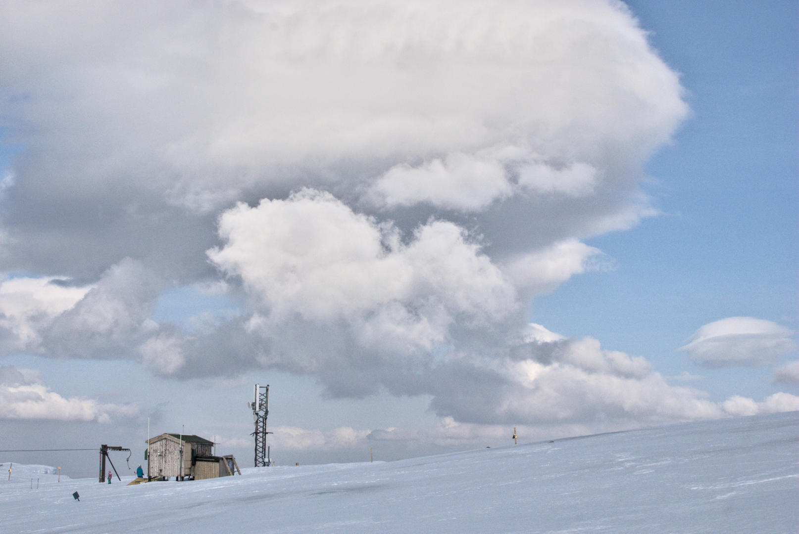
Winter convection from the sea forming cumulus clouds over Aonach Mòr, a little inland from the coast
Image credit: Mehmet Karatay/Northern Aspect Mountaineering
Spring showers
Spring, the transition from winter to summer, can be an interesting time for forecasting showers. The sea is often still cold but the sun is strong enough to make showers over the land.
The first of April was a good example of this. There was a cold northeasterly wind coming in off the North Sea which is about 6C at the moment. This produced showers over the sea which came will have produced light snow showers over the Lammermuir, Cheviot, and Cleveland Hills in the morning. Some made it to the eastern Pennines and Peak District as the day progressed.
By 10:15 UTC (11:15 BST) summer-style land convection was well established and the bulk of England and Wales suddenly filled in with cloud and had the odd light shower because of it.
By afternoon the clouds had grown and showers became more likely and slightly heavier. The convection cells became more organised leading to the air clearing in places in the downdrafts around the clouds. You can see green land appearing over central England from 1330 UTC (1430 BST). This is caused by descending air in the convection cell warming and dissolving cloud. A number of convection cells can share areas of descent; something you can see for yourself in a gently simmering pot at home.
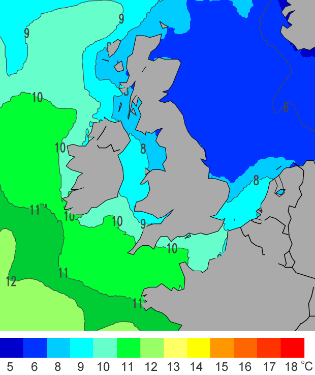
Sea Surface Temperature on 1st April 2022. Notice the north sea is 6C, which was warmer than the cold air blowing across it from the north east.
Image credit: The Beach Guide
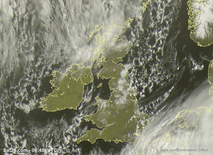
Convection over the North Sea mixing with convection over the land as the day warms up. 1st April 2022.
Image credit: Sat24.com/Eurnet.sat/Met Office

Mehmet Karatay, Northern Aspect Mountaineering
Mehmet is a physics graduate and is training as a forecaster with the Mountain Weather Information Service.